Geolocate

Angoletta topographic map

Click on the map to display elevation.

About this map

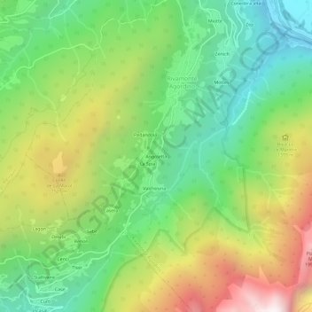
Name: Angoletta topographic map, elevation, terrain.

Location: Angoletta, Rivamonte Agordino, Belluno, Veneto, 32020, Italy (46.22239 11.99879 46.26239 12.03879)

Average elevation: 1,151 m

Minimum elevation: 536 m

Maximum elevation: 2,127 m

Gear up for your next adventure:

🧰Emergency Multi-Tool - Compact multi-tool for outdoor survival
🧥Waterproof Jacket - Lightweight rain jackets for hiking and outdoor activities
Backpacking Tent - Lightweight tent for long-distance hiking trips
💧Hydration Pack - Hands-free hydration system for long hikes
🩹Compact First Aid Kit - Pre-packed essentials for common trail injuries

As an Amazon Associate, this site earns from qualifying purchases at no extra cost to you.