
Thank you for supporting this site ❤️
Make a donation
Make a donation
Gear up for your next adventure:
As an Amazon Associate, this site earns from qualifying purchases at no extra cost to you.
Borgo Jouf / Jôf topographic map
Click on the map to display elevation.
Thank you for supporting this site ❤️
Make a donation
Make a donation
Gear up for your next adventure:
As an Amazon Associate, this site earns from qualifying purchases at no extra cost to you.
About this map
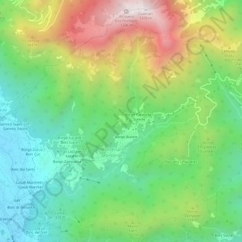
Name: Borgo Jouf / Jôf topographic map, elevation, terrain.
Average elevation: 629 m
Minimum elevation: 210 m
Maximum elevation: 1,347 m
Thank you for supporting this site ❤️
Make a donation
Make a donation
Gear up for your next adventure:
As an Amazon Associate, this site earns from qualifying purchases at no extra cost to you.
Other topographic maps
Click on a map to view its topography, its elevation and its terrain.
Roccolo dal Puestin
Italia > Friuli-Venezia Giulia > Udine > Montenars > Plan di Ploçiut
Average elevation: 592 m