Geolocate

Monte Autore topographic map

Click on the map to display elevation.

About this map

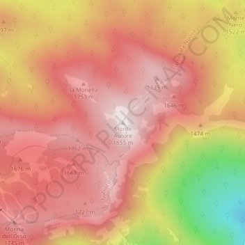
Name: Monte Autore topographic map, elevation, terrain.

Location: Monte Autore, Camerata Nuova, Roma Capitale, Lazio, Italy (41.95836 13.20355 41.95846 13.20365)

Average elevation: 1,577 m

Minimum elevation: 1,034 m

Maximum elevation: 1,839 m

Gear up for your next adventure:

🩹Moleskin Blister Pads - Direct protection for painful foot pressure points
🧥Softshell Jacket - Windproof and breathable jacket for hiking
Camping Coffee Maker - Brew fresh coffee anywhere on the topographic map
🛌Down Sleeping Bag - Superior warmth-to-weight ratio for cold nights
🥾Lightweight Hiking Boots - Boots for comfort and mobility on long hikes

As an Amazon Associate, this site earns from qualifying purchases at no extra cost to you.