
Thank you for supporting this site ❤️
Make a donation
Make a donation
Gear up for your next adventure:
As an Amazon Associate, this site earns from qualifying purchases at no extra cost to you.
Tripur topographic map
Click on the map to display elevation.
Thank you for supporting this site ❤️
Make a donation
Make a donation
Gear up for your next adventure:
As an Amazon Associate, this site earns from qualifying purchases at no extra cost to you.
About this map
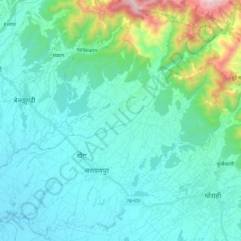
Name: Tripur topographic map, elevation, terrain.
Location: Tripur, Ghorahi, Dang, Lumbini Province, 082, Nepal (28.01358 82.33338 28.15372 82.49568)
Average elevation: 786 m
Minimum elevation: 570 m
Maximum elevation: 1,919 m
Thank you for supporting this site ❤️
Make a donation
Make a donation
Gear up for your next adventure:
As an Amazon Associate, this site earns from qualifying purchases at no extra cost to you.