Geolocate

Gadsari topographic map

Click on the map to display elevation.

About this map

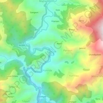
Name: Gadsari topographic map, elevation, terrain.

Location: Gadsari, Thailisain, Pauri Garhwal, Uttarakhand, India (29.95482 79.01290 29.99482 79.05290)

Average elevation: 1,682 m

Minimum elevation: 1,346 m

Maximum elevation: 2,257 m

Other topographic maps

Click on a map to view its topography, its elevation and its terrain.

Tarakund

India > Uttarakhand > Thailisain

Average elevation: 2,127 m

Gear up for your next adventure:

🧦Hiking Socks - Moisture-wicking and comfortable socks for long hikes
❄️Traction Ice Cleats - Slip-on spikes for icy trails and winter hiking
🔨Vehicle Emergency Tool - Safety tool for remote road trips to trailheads
🥾Trail Running Boots - Durable shoes designed for trail running
🥾Lightweight Hiking Boots - Boots for comfort and mobility on long hikes

As an Amazon Associate, this site earns from qualifying purchases at no extra cost to you.