
Thank you for supporting this site ❤️
Make a donation
Make a donation
Gear up for your next adventure:
As an Amazon Associate, this site earns from qualifying purchases at no extra cost to you.
Pihusi topographic map
Click on the map to display elevation.
Thank you for supporting this site ❤️
Make a donation
Make a donation
Gear up for your next adventure:
As an Amazon Associate, this site earns from qualifying purchases at no extra cost to you.
About this map
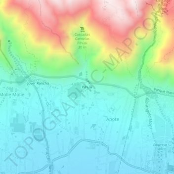
Name: Pihusi topographic map, elevation, terrain.
Location: Pihusi, Apote, Quillacollo, Cochabamba, Bolivia (-17.33718 -66.26645 -17.29718 -66.22645)
Average elevation: 2,860 m
Minimum elevation: 2,626 m
Maximum elevation: 3,467 m
Thank you for supporting this site ❤️
Make a donation
Make a donation
Gear up for your next adventure:
As an Amazon Associate, this site earns from qualifying purchases at no extra cost to you.