Geolocate

Fairview topographic map

Click on the map to display elevation.

About this map

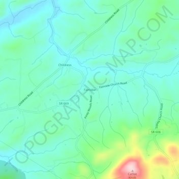
Name: Fairview topographic map, elevation, terrain.

Location: Fairview, Montgomery County, Virginia, United States (37.03068 -80.51755 37.07068 -80.47755)

Average elevation: 630 m

Minimum elevation: 569 m

Maximum elevation: 841 m

Gear up for your next adventure:

🚲Handlebar Phone Mount - View topographic-map.com live while cycling
🛌Insulated Sleeping Pad - Critical thermal barrier between you and the cold ground
🪑Insulated Seat Pad - Protect your seat from cold rocks and wet logs
🧥Waterproof Jacket - Lightweight rain jackets for hiking and outdoor activities
🧤Insulated Winter Gloves - Heavy-duty protection for sub-zero Canadian adventures

As an Amazon Associate, this site earns from qualifying purchases at no extra cost to you.