Geolocate

Quispicancha topographic map

Click on the map to display elevation.

About this map

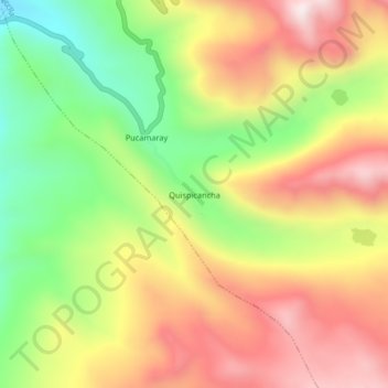
Name: Quispicancha topographic map, elevation, terrain.

Location: Quispicancha, Secclla, Angaraes, Huancavelica, Perú (-13.13342 -74.61416 -13.09342 -74.57416)

Average elevation: 4,304 m

Minimum elevation: 3,962 m

Maximum elevation: 4,633 m

Gear up for your next adventure:

🥾Trail Hiking Socks - Comfortable socks to prevent blisters and fatigue
🧢Outdoor Visor - Breathable visor for sunny hikes
💡LED Headlamp - Hands-free illumination for night hiking and camping
💡Solar Camping Lamp - Eco-friendly lighting for campsites
🥾Trekking Boots - Durable boots for long-distance trekking

As an Amazon Associate, this site earns from qualifying purchases at no extra cost to you.