Geolocate

Menengai topographic map

Click on the map to display elevation.

About this map

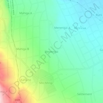
Name: Menengai topographic map, elevation, terrain.

Location: Menengai, Elementeita ward, Gilgil, Nakuru, Kenya (-0.53736 36.05877 -0.49736 36.09877)

Average elevation: 1,919 m

Minimum elevation: 1,815 m

Maximum elevation: 2,164 m

Gear up for your next adventure:

🛶Kayak Accessories - Essential gear for safe and fun kayaking adventures
🧰Multitool Knife - Compact and versatile tool for outdoor use
🧢Hiking Hat - Sun-protective and breathable hats for long treks
🧤Insulated Winter Gloves - Heavy-duty protection for sub-zero Canadian adventures
🧴Outdoor Sunscreen - High SPF protection for high-altitude UV exposure

As an Amazon Associate, this site earns from qualifying purchases at no extra cost to you.