Geolocate

Carranglan topographic map

Click on the map to display elevation.

About this map

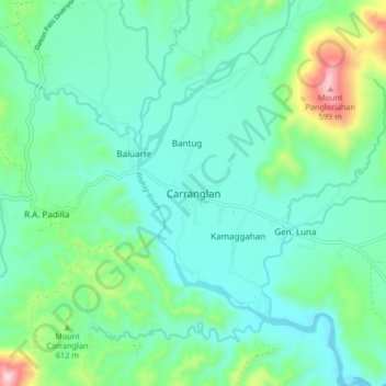
Name: Carranglan topographic map, elevation, terrain.

Location: Carranglan, Nueva Ecija, Central Luzon, Philippines (15.92066 121.02387 16.00066 121.10387)

Average elevation: 296 m

Minimum elevation: 203 m

Maximum elevation: 632 m

Gear up for your next adventure:

🥾Hiking Boots - Sturdy boots providing ankle support and traction on rugged trails
🔋Lithium AA Batteries - Long-lasting power that performs in extreme cold
🧣Evaporative Cooling Towel - Beat the heat during intense summer climbs
🧭Orienteering Kit - Tools for map reading and navigation in the wild
🥾Hiking Gaiters - Protect legs and shoes from mud, snow, and debris

As an Amazon Associate, this site earns from qualifying purchases at no extra cost to you.