Geolocate

Dummerstorf topographic map

Click on the map to display elevation.

About this map
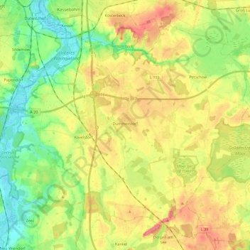
Name: Dummerstorf topographic map, elevation, terrain.

Location: Dummerstorf, Landkreis Rostock, Mecklenburg-Voor-Pommeren, 18196, Duitsland (53.95351 12.11822 54.07106 12.33776)

Average elevation: 34 m

Minimum elevation: -1 m

Maximum elevation: 73 m

Other topographic maps

Click on a map to view its topography, its elevation and its terrain.

Gear up for your next adventure:

🧰Multitool Knife - Compact and versatile tool for outdoor use
🚲MTB Frame Bag - Carry tools and maps directly on your bicycle frame
🧴First Aid Kit - Essential first aid supplies for outdoor emergencies
🛰️Satellite Messenger - Emergency communication for areas with no cell service
🗺️Topographic Maps - Detailed maps to explore trails, mountains, and wilderness areas

As an Amazon Associate, this site earns from qualifying purchases at no extra cost to you.