Geolocate

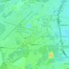
Pichey topographic map

Click on the map to display elevation.

About this map

Name: Pichey topographic map, elevation, terrain.

Location: Pichey, Centre ville, Mérignac, Bordeaux, Gironde, Nouvelle-Aquitaine, France métropolitaine, 33700, France (44.82350 -0.68919 44.86350 -0.64919)

Average elevation: 43 m

Minimum elevation: 22 m

Maximum elevation: 52 m

Other topographic maps

Click on a map to view its topography, its elevation and its terrain.

Chemin Long

France > Nouvelle-Aquitaine > Gironde > Mérignac

Average elevation: 43 m

Beutre

France > Nouvelle-Aquitaine > Gironde > Mérignac

Average elevation: 48 m

Bourran

France > Nouvelle-Aquitaine > Gironde > Mérignac

Average elevation: 31 m

Arlac

France > Nouvelle-Aquitaine > Gironde > Mérignac

Average elevation: 25 m

33700

France > Nouvelle-Aquitaine > Gironde > Mérignac

Average elevation: 40 m
Arlac

France > Nouvelle-Aquitaine > Gironde > Mérignac

Average elevation: 25 m

Gear up for your next adventure:

🎒Fully Waterproof Backpack - Total protection for photography gear and electronics
🎒Hiking Backpack - Lightweight and ergonomic backpacks for day hikes or multi-day treks
🧦Hiking Socks - Moisture-wicking and comfortable socks for long hikes
🧢Hiking Sun Hat - Wide-brimmed protection for exposed mountain ridges
🚲MTB Frame Bag - Carry tools and maps directly on your bicycle frame

As an Amazon Associate, this site earns from qualifying purchases at no extra cost to you.