Geolocate

Balchik topographic map

Click on the map to display elevation.

About this map
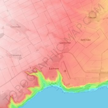
Name: Balchik topographic map, elevation, terrain.

Location: Balchik, Dobrich, Bulgaria (43.38058 28.09064 43.50399 28.25175)

Average elevation: 172 m

Minimum elevation: 0 m

Maximum elevation: 255 m

Other topographic maps

Click on a map to view its topography, its elevation and its terrain.
Cape Kaliakra

Bulgaria > Dobrich > Balgarevo

Average elevation: 2 m

Gear up for your next adventure:

🧥Fleece Jacket - Warm and lightweight jacket for layering
🥾Mountain Trail Shoes - High-traction shoes for mountain trails
🧦Hiking Liner Socks - Thin base layer to prevent friction and blisters
🧢Outdoor Cap - Protective cap for sun and rain during hikes
🥾Waterproof Hiking Boots - Essential footwear for rugged terrain and wet Canadian trails

As an Amazon Associate, this site earns from qualifying purchases at no extra cost to you.