Geolocate

Yacuanquer topographic map

Click on the map to display elevation.

About this map

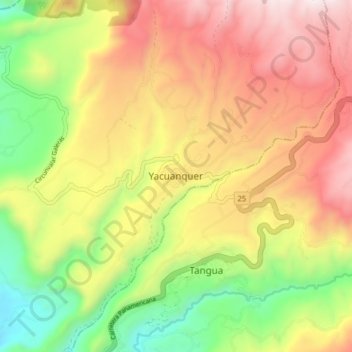
Name: Yacuanquer topographic map, elevation, terrain.

Location: Yacuanquer, Centro, Nariño, RAP Pacífico, Colombia (1.07588 -77.44176 1.15588 -77.36176)

Average elevation: 2,623 m

Minimum elevation: 1,928 m

Maximum elevation: 3,332 m

Other topographic maps

Click on a map to view its topography, its elevation and its terrain.

Laguna

Colombia > Nariño > Yacuanquer

Average elevation: 3,642 m

Gear up for your next adventure:

🔋Solar Power Bank - Keep your GPS and devices charged during long outdoor trips
🧥Fleece Jacket - Warm and lightweight jacket for layering
🧴Outdoor Sunscreen - High SPF protection for high-altitude UV exposure
Family Camping Tent - Spacious tent suitable for family camping trips
💧Hydration Pack - Hands-free hydration system for long hikes

As an Amazon Associate, this site earns from qualifying purchases at no extra cost to you.