
Monte Schiara topographic map
Click on the map to display elevation.
Monte Schiara
The Schiara (Italian: Monte Schiara) is a mountain in the southern Dolomites of Veneto in northern Italy. It is located just north of the town of Belluno, approximately 50 miles north of Venice. Monte Schiara has an elevation of 2,565 metres.
About this map
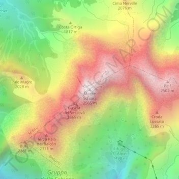
Name: Monte Schiara topographic map, elevation, terrain.
Location: Monte Schiara, Sedico, Belluno, Veneto, 32036, Italy (46.22995 12.18217 46.23005 12.18227)
Average elevation: 1,852 m
Minimum elevation: 1,149 m
Maximum elevation: 2,566 m