Geolocate

Zotlang topographic map

Click on the map to display elevation.

About this map

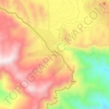
Name: Zotlang topographic map, elevation, terrain.

Location: Zotlang, Champhai, Champhai district, Mizoram, India (23.42573 93.31881 23.46573 93.35881)

Average elevation: 1,309 m

Minimum elevation: 882 m

Maximum elevation: 1,609 m

Gear up for your next adventure:

🥾Durable Hiking Shoes - Long-lasting shoes for frequent hiking
🔭Compact Binoculars - Lightweight optics for scouting trails and wildlife
👟Trail Running Shoes - Agile footwear for fast-paced topographic exploration
🚲MTB Frame Bag - Carry tools and maps directly on your bicycle frame
🔋Emergency Crank Radio - Weather alerts and power without needing batteries

As an Amazon Associate, this site earns from qualifying purchases at no extra cost to you.