Geolocate

Pedriza topographic map

Click on the map to display elevation.

About this map

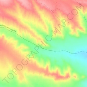
Name: Pedriza topographic map, elevation, terrain.

Location: Pedriza, Mediana de Aragón, Zaragoza, Aragón, España (41.38792 -0.70428 41.40792 -0.68428)

Average elevation: 368 m

Minimum elevation: 296 m

Maximum elevation: 424 m

Gear up for your next adventure:

🛶Canoe Life Vest - Safety vest for water sports
🧴Sunscreen SPF - Broad-spectrum sunscreen for outdoor activities
🔦LED Headtorch - Bright and durable light for night activities
Tent Footprint - Protect tent floor and increase durability
🚲Heavy Duty Bike Lock - Secure your bike at the trailhead or during stops

As an Amazon Associate, this site earns from qualifying purchases at no extra cost to you.