Geolocate

Gwar topographic map

Click on the map to display elevation.

About this map

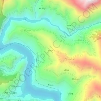
Name: Gwar topographic map, elevation, terrain.

Location: Gwar, Oklakhal, Pratapnagar, Tehri Garhwal, Uttarakhand, India (30.44806 78.41650 30.48806 78.45650)

Average elevation: 1,042 m

Minimum elevation: 705 m

Maximum elevation: 1,752 m

Gear up for your next adventure:

🥾Light Hiking Boots - Lightweight and comfortable boots for day hikes
🥘Camping Cookware Set - Compact nesting pots and pans for trail cooking
🥾Waterproof Hiking Boots - Essential footwear for rugged terrain and wet Canadian trails
🚑Survival Whistle - Signal for help across long distances in mountains
🥾Mountain Hiking Shoes - Shoes with superior grip for mountainous terrain

As an Amazon Associate, this site earns from qualifying purchases at no extra cost to you.