Geolocate

Kankakee topographic map

Click on the map to display elevation.

About this map

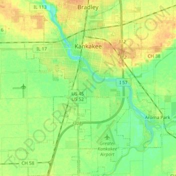
Name: Kankakee topographic map, elevation, terrain.

Location: Kankakee, Kankakee County, Illinois, 60901, United States (41.04700 -87.92098 41.14594 -87.82118)

Average elevation: 192 m

Minimum elevation: 179 m

Maximum elevation: 206 m

Other topographic maps

Click on a map to view its topography, its elevation and its terrain.

Pilot Hill

United States > Illinois > Kankakee County

Average elevation: 215 m

Gear up for your next adventure:

🧴Insect Repellent - Protect yourself from bugs during outdoor adventures
🧭Orienteering Kit - Tools for map reading and navigation in the wild
Backpacking Tent - Lightweight tent for long-distance hiking trips
🦶Hiking Shoe Insoles - Added support for high arches and long days on feet
👟Trail Running Shoes - Agile footwear for fast-paced topographic exploration

As an Amazon Associate, this site earns from qualifying purchases at no extra cost to you.