
Thank you for supporting this site ❤️
Make a donation
Make a donation
Gear up for your next adventure:
As an Amazon Associate, this site earns from qualifying purchases at no extra cost to you.
دهستان جویم topographic map
Click on the map to display elevation.
Thank you for supporting this site ❤️
Make a donation
Make a donation
Gear up for your next adventure:
As an Amazon Associate, this site earns from qualifying purchases at no extra cost to you.
About this map
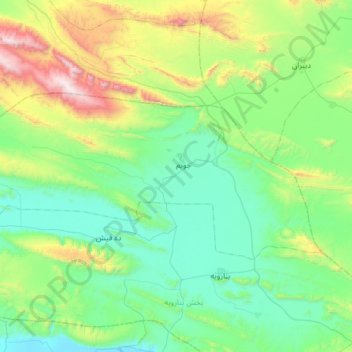
Name: دهستان جویم topographic map, elevation, terrain.
Location: دهستان جویم, بخش جویم, Larestan County, Fars Province, Iran (28.10814 53.61220 28.36370 54.22529)
Average elevation: 1,152 m
Minimum elevation: 751 m
Maximum elevation: 2,650 m
Thank you for supporting this site ❤️
Make a donation
Make a donation
Gear up for your next adventure:
As an Amazon Associate, this site earns from qualifying purchases at no extra cost to you.