Geolocate

Kaniyur topographic map

Click on the map to display elevation.

About this map

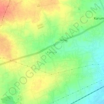
Name: Kaniyur topographic map, elevation, terrain.

Location: Kaniyur, Sulur, Coimbatore, Tamil Nadu, 641407, India (11.07461 77.13532 11.11461 77.17532)

Average elevation: 367 m

Minimum elevation: 342 m

Maximum elevation: 393 m

Other topographic maps

Click on a map to view its topography, its elevation and its terrain.

Senjerimalai

India > Tamil Nadu > Sulur > Senjerimalai

Average elevation: 372 m

Pattanam

India > Tamil Nadu > Sulur

Average elevation: 391 m

Noyyal River

India > Tamil Nadu > Sulur

Average elevation: 376 m

Gear up for your next adventure:

🪑Ultralight Camping Stool - Compact seating for rest stops during long hikes
🧭GPS Tracker - Track your location in remote areas safely
🧢Hiking Hat - Sun-protective and breathable hats for long treks
🧼Biodegradable Camp Soap - Environmentally friendly cleaning for gear and body
🦶Anti-Blister Balm - Prevents friction and hotspots during long ascents

As an Amazon Associate, this site earns from qualifying purchases at no extra cost to you.