
Thank you for supporting this site ❤️
Make a donation
Make a donation
Gear up for your next adventure:
As an Amazon Associate, this site earns from qualifying purchases at no extra cost to you.
Gorgoço topographic map
Click on the map to display elevation.
Thank you for supporting this site ❤️
Make a donation
Make a donation
Gear up for your next adventure:
As an Amazon Associate, this site earns from qualifying purchases at no extra cost to you.
About this map
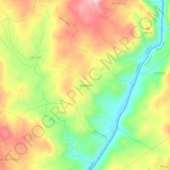
Name: Gorgoço topographic map, elevation, terrain.
Location: Gorgoço, Santa Valha, Valpaços, Vila Real, 5385-032, Portugal (41.64997 -7.25801 41.68997 -7.21801)
Average elevation: 389 m
Minimum elevation: 256 m
Maximum elevation: 526 m
Thank you for supporting this site ❤️
Make a donation
Make a donation
Gear up for your next adventure:
As an Amazon Associate, this site earns from qualifying purchases at no extra cost to you.