Geolocate

Inverhaugh topographic map

Click on the map to display elevation.

About this map

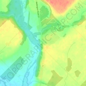
Name: Inverhaugh topographic map, elevation, terrain.

Location: Inverhaugh, Centre Wellington, Wellington County, Southwestern Ontario, Ontario, N0B 1S0, Canada (43.62736 -80.44943 43.64736 -80.42943)

Average elevation: 356 m

Minimum elevation: 332 m

Maximum elevation: 384 m

Other topographic maps

Click on a map to view its topography, its elevation and its terrain.

Gear up for your next adventure:

🥾Trail Hiking Socks - Comfortable socks to prevent blisters and fatigue
📷Outdoor Action Camera - Capture high-elevation views and rugged adventures
💡LED Headlamp - Hands-free illumination for night hiking and camping
🧴Insect Repellent - Protect yourself from bugs during outdoor adventures
🥾Hiking Leggings - Comfortable leggings for outdoor activities

As an Amazon Associate, this site earns from qualifying purchases at no extra cost to you.