Geolocate

Preston topographic map

Click on the map to display elevation.

About this map

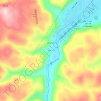
Name: Preston topographic map, elevation, terrain.

Location: Preston, Preston County, West Virginia, 26537, United States (39.41509 -79.70561 39.45509 -79.66561)

Average elevation: 502 m

Minimum elevation: 373 m

Maximum elevation: 631 m

Gear up for your next adventure:

Camping Groundsheet - Protect your tent from moisture and dirt
🛁Quick-Dry Microfiber Towel - Space-saving towel that dries rapidly on the move
📷Outdoor Action Camera - Capture high-elevation views and rugged adventures
🌡️Emergency Mylar Blankets - Compact thermal protection for unexpected nights outdoors
🔋Solar Power Bank - Keep your GPS and devices charged during long outdoor trips

As an Amazon Associate, this site earns from qualifying purchases at no extra cost to you.