
Thank you for supporting this site ❤️
Make a donation
Make a donation
Gear up for your next adventure:
As an Amazon Associate, this site earns from qualifying purchases at no extra cost to you.
Plateria topographic map
Click on the map to display elevation.
Thank you for supporting this site ❤️
Make a donation
Make a donation
Gear up for your next adventure:
As an Amazon Associate, this site earns from qualifying purchases at no extra cost to you.
About this map
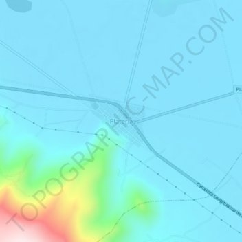
Name: Plateria topographic map, elevation, terrain.
Location: Plateria, Platería, Provincia de Puno, Puno, Perú (-15.96797 -69.85287 -15.92797 -69.81287)
Average elevation: 3,861 m
Minimum elevation: 3,812 m
Maximum elevation: 4,261 m
Thank you for supporting this site ❤️
Make a donation
Make a donation
Gear up for your next adventure:
As an Amazon Associate, this site earns from qualifying purchases at no extra cost to you.