Geolocate

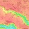
78114 topographic map

Click on the map to display elevation.

About this map

Name: 78114 topographic map, elevation, terrain.

Location: 78114, Magny-les-Hameaux, Rambouillet, Yvelines, Île-de-France, France métropolitaine, France (48.71375 1.99205 48.76199 2.10618)

Average elevation: 147 m

Minimum elevation: 67 m

Maximum elevation: 182 m

Other topographic maps

Click on a map to view its topography, its elevation and its terrain.
Gear up for your next adventure:

⛺Bushcraft Tarp - Versatile emergency shelter or gear protection
🛶Kayak Dry Bag - Waterproof storage for kayaking adventures
📷Outdoor Action Camera - Capture high-elevation views and rugged adventures
☕Camping Coffee Maker - Brew fresh coffee anywhere on the topographic map
🎒Backpack Rain Cover - External shield to keep your entire pack dry

As an Amazon Associate, this site earns from qualifying purchases at no extra cost to you.