Geolocate

Braunfels topographic map

Click on the map to display elevation.

About this map

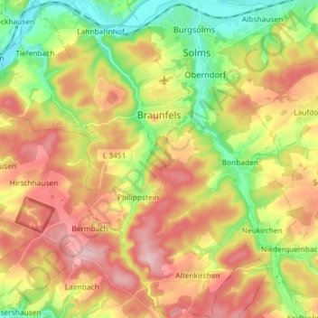
Name: Braunfels topographic map, elevation, terrain.

Location: Braunfels, Lahn-Dill-Kreis, Hesse, Germany (50.45627 8.31235 50.54840 8.45394)

Average elevation: 242 m

Minimum elevation: 133 m

Maximum elevation: 356 m

Gear up for your next adventure:

🌡️Emergency Mylar Blankets - Compact thermal protection for unexpected nights outdoors
🧥Softshell Jacket - Windproof and breathable jacket for hiking
🥾Durable Hiking Shoes - Long-lasting shoes for frequent hiking
🔦LED Flashlight - Powerful and long-lasting flashlight for camping and emergencies
💧Collapsible Water Bottle - Space-saving water bottle for outdoor activities

As an Amazon Associate, this site earns from qualifying purchases at no extra cost to you.