
Thank you for supporting this site ❤️
Make a donation
Make a donation
Gear up for your next adventure:
As an Amazon Associate, this site earns from qualifying purchases at no extra cost to you.
Modinagar topographic map
Click on the map to display elevation.
Thank you for supporting this site ❤️
Make a donation
Make a donation
Gear up for your next adventure:
As an Amazon Associate, this site earns from qualifying purchases at no extra cost to you.
About this map
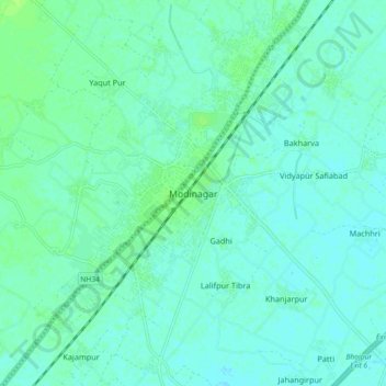
Name: Modinagar topographic map, elevation, terrain.
Location: Modinagar, Ghaziabad, Uttar Pradesh, 201204, India (28.79207 77.53709 28.87207 77.61709)
Average elevation: 220 m
Minimum elevation: 217 m
Maximum elevation: 226 m
Thank you for supporting this site ❤️
Make a donation
Make a donation
Gear up for your next adventure:
As an Amazon Associate, this site earns from qualifying purchases at no extra cost to you.