Geolocate

Voia topographic map

Click on the map to display elevation.

About this map

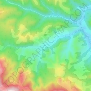
Name: Voia topographic map, elevation, terrain.

Location: Voia, Balșa, Hunedoara, 337031, Romania (46.01688 23.02634 46.05688 23.06634)

Average elevation: 526 m

Minimum elevation: 348 m

Maximum elevation: 852 m

Gear up for your next adventure:

💡LED Headlamp - Hands-free illumination for night hiking and camping
🥾Light Hiking Boots - Lightweight and comfortable boots for day hikes
🥾Hiking Gaiters - Protect legs and shoes from mud, snow, and debris
🛶Canoe Life Vest - Safety vest for water sports
🥾Waterproof Hiking Shoes - Durable shoes for wet and rugged trails

As an Amazon Associate, this site earns from qualifying purchases at no extra cost to you.