Geolocate

Faro topographic map

Click on the map to display elevation.

About this map

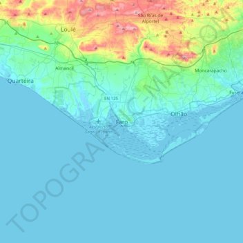
Name: Faro topographic map, elevation, terrain.

Location: Faro, 8000-268, Portugal (36.85627 -8.09518 37.17627 -7.77518)

Average elevation: 53 m

Minimum elevation: -3 m

Maximum elevation: 408 m

Gear up for your next adventure:

🧢Hiking Sun Hat - Wide-brimmed protection for exposed mountain ridges
🧭Orienteering Kit - Tools for map reading and navigation in the wild
🚑Survival Whistle - Signal for help across long distances in mountains
🕶️Polarized Sunglasses - Protect your eyes with durable polarized lenses
🏕️Camping Hammock - Integrated protection for sleeping between trees

As an Amazon Associate, this site earns from qualifying purchases at no extra cost to you.