
Thank you for supporting this site ❤️
Make a donation
Make a donation
Gear up for your next adventure:
As an Amazon Associate, this site earns from qualifying purchases at no extra cost to you.
Khhang Shiling topographic map
Click on the map to display elevation.
Thank you for supporting this site ❤️
Make a donation
Make a donation
Gear up for your next adventure:
As an Amazon Associate, this site earns from qualifying purchases at no extra cost to you.
About this map
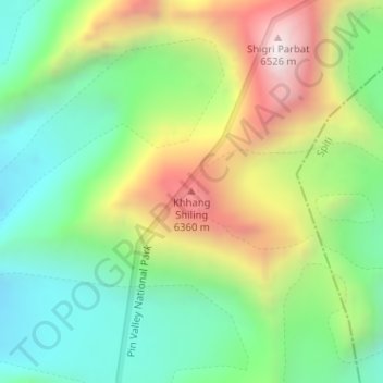
Name: Khhang Shiling topographic map, elevation, terrain.
Location: Khhang Shiling, Lahul, Lahul and Spiti, Himachal Pradesh, Inde (32.12596 77.76866 32.12606 77.76876)
Average elevation: 5,847 m
Minimum elevation: 5,431 m
Maximum elevation: 6,522 m
Thank you for supporting this site ❤️
Make a donation
Make a donation
Gear up for your next adventure:
As an Amazon Associate, this site earns from qualifying purchases at no extra cost to you.