Geolocate

pilkhi topographic map

Click on the map to display elevation.

About this map

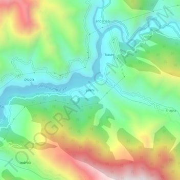
Name: pilkhi topographic map, elevation, terrain.

Location: pilkhi, Ghansali, Tehri Garhwal, Uttarakhand, 249181, India (30.39569 78.61694 30.43569 78.65694)

Average elevation: 1,156 m

Minimum elevation: 791 m

Maximum elevation: 1,842 m

Gear up for your next adventure:

🥾Waterproof Hiking Boots - Essential footwear for rugged terrain and wet Canadian trails
🥾Mountain Trail Shoes - High-traction shoes for mountain trails
🧦Outdoor Socks - Durable socks designed for hiking and outdoor sports
🛁Quick-Dry Microfiber Towel - Space-saving towel that dries rapidly on the move
💡Portable Camping Lamp - Rechargeable lamp for campsite lighting

As an Amazon Associate, this site earns from qualifying purchases at no extra cost to you.