Geolocate

Ringelspitz topographic map

Click on the map to display elevation.

About this map

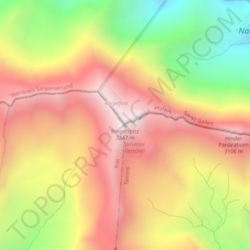
Name: Ringelspitz topographic map, elevation, terrain.

Location: Ringelspitz, Trin, Imboden, Grisons, Switzerland (46.89828 9.34301 46.89838 9.34311)

Average elevation: 2,628 m

Minimum elevation: 1,909 m

Maximum elevation: 3,205 m

Gear up for your next adventure:

🔦LED Headlamp - Hands-free lighting for early morning starts or late finishes
Backpacking Tent - Lightweight tent for long-distance hiking trips
🚲MTB Frame Bag - Carry tools and maps directly on your bicycle frame
Lightweight Backpacking Tent - Compact tent for efficient hiking trips
🥾Waterproof Trail Shoes - Shoes designed to handle wet terrain

As an Amazon Associate, this site earns from qualifying purchases at no extra cost to you.