
Thank you for supporting this site ❤️
Make a donation
Make a donation
Gear up for your next adventure:
As an Amazon Associate, this site earns from qualifying purchases at no extra cost to you.
Çaksına topographic map
Click on the map to display elevation.
Thank you for supporting this site ❤️
Make a donation
Make a donation
Gear up for your next adventure:
As an Amazon Associate, this site earns from qualifying purchases at no extra cost to you.
About this map
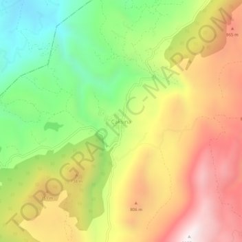
Name: Çaksına topographic map, elevation, terrain.
Location: Çaksına, Yayladağı, Hatay, Mediterranean Region, Turkey (36.04663 36.07753 36.08663 36.11753)
Average elevation: 592 m
Minimum elevation: 71 m
Maximum elevation: 1,135 m
Thank you for supporting this site ❤️
Make a donation
Make a donation
Gear up for your next adventure:
As an Amazon Associate, this site earns from qualifying purchases at no extra cost to you.