
Nurney topographic map
Interactive map
Click on the map to display elevation.
About this map
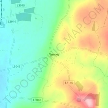
Name: Nurney topographic map, elevation, terrain.
Average elevation: 105 m
Minimum elevation: 45 m
Maximum elevation: 210 m
Other topographic maps
Click on a map to view its topography, its elevation and its terrain.
Mountain River
Mountain River, The Municipal District of Muinebeag, County Carlow, Leinster, Ireland
Average elevation: 136 m