Geolocate

El Ahorcado topographic map

Click on the map to display elevation.

About this map

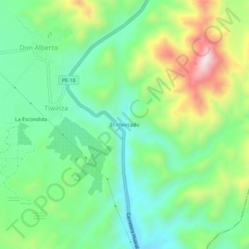
Name: El Ahorcado topographic map, elevation, terrain.

Location: El Ahorcado, Tiwinza, Sayán, Huaura, Lima, Perú (-11.28949 -77.34587 -11.24949 -77.30587)

Average elevation: 496 m

Minimum elevation: 330 m

Maximum elevation: 825 m

Gear up for your next adventure:

🧦Thermal Socks - Warm socks for winter hiking or camping
🧥Packable Rain Jacket - Breathable waterproof layer for unpredictable weather
🥾Trekking Boots - Durable boots for long-distance trekking
🥾Hiking Leggings - Comfortable leggings for outdoor activities
🦶Hiking Shoe Insoles - Added support for high arches and long days on feet

As an Amazon Associate, this site earns from qualifying purchases at no extra cost to you.