Geolocate

Chuin topographic map

Click on the map to display elevation.

About this map

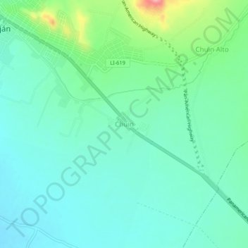
Name: Chuin topographic map, elevation, terrain.

Location: Chuin, Paiján, Ascope, La Libertad, Perú (-7.76981 -79.30293 -7.72981 -79.26293)

Average elevation: 87 m

Minimum elevation: 57 m

Maximum elevation: 186 m

Gear up for your next adventure:

🧥Thermal Layer - Insulating layer for cold outdoor conditions
👟Trail Running Shoes - Agile footwear for fast-paced topographic exploration
🧭GPS Handheld Device - Reliable GPS navigation for outdoor adventures
🔦LED Headlamp - Hands-free lighting for early morning starts or late finishes
🏕️Camping Hammock - Integrated protection for sleeping between trees

As an Amazon Associate, this site earns from qualifying purchases at no extra cost to you.