
Hopfgarten topographic map
Interactive map
Click on the map to display elevation.
About this map
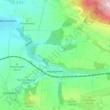
Name: Hopfgarten topographic map, elevation, terrain.
Average elevation: 282 m
Minimum elevation: 203 m
Maximum elevation: 481 m
Other topographic maps
Click on a map to view its topography, its elevation and its terrain.
Kranichfeld
Duitsland > Thüringen > Landkreis Weimarer Land
Kranichfeld, Landkreis Weimarer Land, Thüringen, 99448, Duitsland
Average elevation: 383 m