Geolocate

Menlou topographic map

Click on the map to display elevation.

About this map

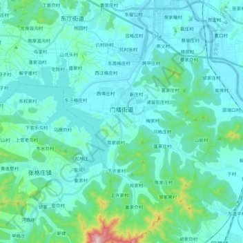
Name: Menlou topographic map, elevation, terrain.

Location: Menlou, Fushan District, Yantai, Shandong, 265500, China (37.33585 121.19311 37.48125 121.36427)

Average elevation: 75 m

Minimum elevation: 0 m

Maximum elevation: 622 m

Gear up for your next adventure:

📷Outdoor Action Camera - Capture high-elevation views and rugged adventures
🥘Camping Cookware Set - Compact nesting pots and pans for trail cooking
🦯Trekking Poles - Reduced impact on joints for steep topographic climbs
🛏️Camping Sleeping Mat - Comfortable mats for sleeping outdoors
🛌Insulated Sleeping Pad - Critical thermal barrier between you and the cold ground

As an Amazon Associate, this site earns from qualifying purchases at no extra cost to you.