Geolocate

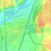
Romeoville topographic map

Click on the map to display elevation.

About this map
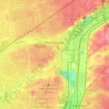
Name: Romeoville topographic map, elevation, terrain.

Location: Romeoville, Will County, Illinois, 60446, United States (41.59269 -88.16311 41.67988 -88.02857)

Average elevation: 196 m

Minimum elevation: 144 m

Maximum elevation: 230 m

Other topographic maps

Click on a map to view its topography, its elevation and its terrain.
Drummond

United States > Illinois > Will County

Average elevation: 167 m

Marley

United States > Illinois > Will County

Average elevation: 214 m

Puddle Pond

United States > Illinois > Will County > Plainfield

Average elevation: 187 m

Arbury Hills

United States > Illinois > Will County

Average elevation: 216 m

Gear up for your next adventure:

⛺Tent Footprint - Protect tent floor and increase durability
🔥Camping Stove - Portable stoves to cook outdoors with ease
🧥Waterproof Hiking Jacket - Protect yourself from rain and wind while hiking
🧣Merino Neck Gaiter - Protects against wind, sun, and cold at high altitudes
🧭GPS Outdoor Watch - Smart watch for navigation and fitness tracking in nature

As an Amazon Associate, this site earns from qualifying purchases at no extra cost to you.