Geolocate

El Playón topographic map

Click on the map to display elevation.

About this map

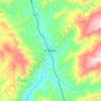
Name: El Playón topographic map, elevation, terrain.

Location: El Playón, Metropolitana, Santander, Colombia (7.43089 -73.24331 7.51089 -73.16331)

Average elevation: 763 m

Minimum elevation: 341 m

Maximum elevation: 1,432 m

Gear up for your next adventure:

🧊Insulated Water Bottle - Keeps drinks cold in summer and prevents freezing in winter
🧢Sun Hat - Wide-brim hat for sun protection
🥾Trail Hiking Socks - Comfortable socks to prevent blisters and fatigue
🧤Rechargeable Heated Gloves - Extreme warmth for Canadian winter expeditions
🧢Sun Protection Cap - Breathable cap to protect from sun exposure

As an Amazon Associate, this site earns from qualifying purchases at no extra cost to you.