Geolocate

Thüngersheim topographic map

Click on the map to display elevation.

About this map
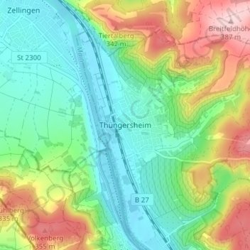
Name: Thüngersheim topographic map, elevation, terrain.

Location: Thüngersheim, Landkreis Würzburg, Bayern, 97291, Deutschland (49.85993 9.82212 49.89993 9.86212)

Average elevation: 240 m

Minimum elevation: 162 m

Maximum elevation: 388 m

Gear up for your next adventure:

🥾Durable Hiking Shoes - Long-lasting shoes for frequent hiking
👟Sport Hiking Sandals - Breathable footwear for water crossings and camp rest
🩹Moleskin Blister Pads - Direct protection for painful foot pressure points
🦶Hiking Shoe Insoles - Added support for high arches and long days on feet
🎒Hiking Backpack - Lightweight and ergonomic backpacks for day hikes or multi-day treks

As an Amazon Associate, this site earns from qualifying purchases at no extra cost to you.