Geolocate

Silvia topographic map

Click on the map to display elevation.

About this map

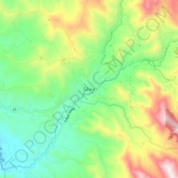
Name: Silvia topographic map, elevation, terrain.

Location: Silvia, Centro, Cauca, Colombia (2.57154 -76.41842 2.65154 -76.33842)

Average elevation: 2,684 m

Minimum elevation: 2,285 m

Maximum elevation: 3,386 m

Gear up for your next adventure:

🛌Insulated Sleeping Pad - Critical thermal barrier between you and the cold ground
👟Leg Gaiters - Keep debris, mud, and snow out of your boots
🩹Moleskin Blister Pads - Direct protection for painful foot pressure points
💡Compact LED Flashlight - Powerful and portable flashlight for outdoor use
🥾Lightweight Hiking Boots - Boots for comfort and mobility on long hikes

As an Amazon Associate, this site earns from qualifying purchases at no extra cost to you.