Geolocate

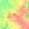
Curel topographic map

Click on the map to display elevation.

About this map

Name: Curel topographic map, elevation, terrain.

Location: Curel, Saint-Dizier, Haute-Marne, Grand Est, Metropolitan France, 52300, France (48.48385 5.12328 48.51381 5.16863)

Average elevation: 237 m

Minimum elevation: 169 m

Maximum elevation: 327 m

Other topographic maps

Click on a map to view its topography, its elevation and its terrain.

Soôte

France > Grand Est > Haute-Marne > Longeau-Percey

Average elevation: 345 m

Saint-Mars

France > Grand Est > Haute-Marne > Louvemont

Average elevation: 152 m

Le Canar

France > Grand Est > Haute-Marne > Saints-Geosmes

Average elevation: 444 m

Gear up for your next adventure:

☕Camping Coffee Maker - Brew fresh coffee anywhere on the topographic map
🌡️Emergency Mylar Blankets - Compact thermal protection for unexpected nights outdoors
🛏️Sleeping Bag - Warm and compact sleeping bags for outdoor camping
🧴First Aid Kit - Essential first aid supplies for outdoor emergencies
🧣Merino Neck Gaiter - Protects against wind, sun, and cold at high altitudes

As an Amazon Associate, this site earns from qualifying purchases at no extra cost to you.