Geolocate

Shore Drive topographic map

Click on the map to display elevation.

About this map

Name: Shore Drive topographic map, elevation, terrain.

Location: Shore Drive, Norton, Bristol County, Massachusetts, United States (41.98808 -71.21105 41.99035 -71.20793)

Average elevation: 34 m

Minimum elevation: 25 m

Maximum elevation: 46 m

Other topographic maps

Click on a map to view its topography, its elevation and its terrain.
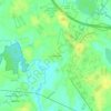
Chartley

United States > Massachusetts > Bristol County > Norton

Average elevation: 32 m

Gear up for your next adventure:

🥾Mountain Hiking Boots - High-traction boots for rocky terrain
🧭GPS Outdoor Watch - Smart watch for navigation and fitness tracking in nature
🛶Waterproof Dry Bags - Keep electronics and clothes dry during river crossings
👟Trail Running Shoes - Agile footwear for fast-paced topographic exploration
💡Portable Camping Lamp - Rechargeable lamp for campsite lighting

As an Amazon Associate, this site earns from qualifying purchases at no extra cost to you.