Geolocate

River Falls topographic map

Click on the map to display elevation.

About this map

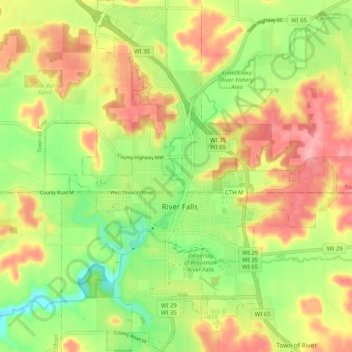
Name: River Falls topographic map, elevation, terrain.

Location: River Falls, Pierce County, Wisconsin, 54022, United States (44.82955 -92.66479 44.90229 -92.57965)

Average elevation: 291 m

Minimum elevation: 234 m

Maximum elevation: 350 m

Other topographic maps

Click on a map to view its topography, its elevation and its terrain.

Gear up for your next adventure:

🔋Emergency Crank Radio - Weather alerts and power without needing batteries
🧢Outdoor Cap - Protective cap for sun and rain during hikes
🩹Compact First Aid Kit - Pre-packed essentials for common trail injuries
📷Outdoor Action Camera - Capture high-elevation views and rugged adventures
🧴Bear Spray Holster - Quick-access carry for essential Canadian wilderness safety

As an Amazon Associate, this site earns from qualifying purchases at no extra cost to you.