Geolocate

Saint Charles topographic map

Click on the map to display elevation.

About this map

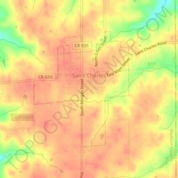
Name: Saint Charles topographic map, elevation, terrain.

Location: Saint Charles, Madison County, Iowa, United States (41.27747 -93.81840 41.29503 -93.79919)

Average elevation: 316 m

Minimum elevation: 278 m

Maximum elevation: 329 m

Other topographic maps

Click on a map to view its topography, its elevation and its terrain.

Barney

United States > Iowa > Madison County

Average elevation: 346 m

Gear up for your next adventure:

🏕️Camping Hammock - Integrated protection for sleeping between trees
🧦Hiking Socks - Moisture-wicking and comfortable socks for long hikes
🧦Hiking Liner Socks - Thin base layer to prevent friction and blisters
🦟Insect Repellent - Keep mosquitoes and black flies away in wooded areas
🥾Mountain Hiking Boots - High-traction boots for rocky terrain

As an Amazon Associate, this site earns from qualifying purchases at no extra cost to you.