Geolocate

Punschern topographic map

Click on the map to display elevation.

About this map

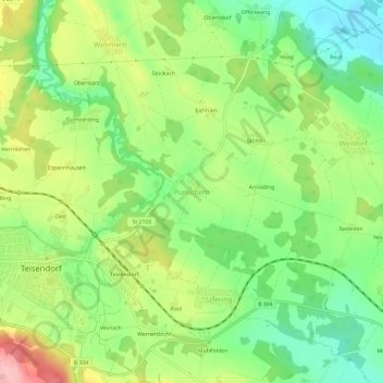
Name: Punschern topographic map, elevation, terrain.

Location: Punschern, Teisendorf, Landkreis Berchtesgadener Land, Bayern, 83317, Deutschland (47.83698 12.82533 47.87698 12.86533)

Average elevation: 492 m

Minimum elevation: 431 m

Maximum elevation: 578 m

Other topographic maps

Click on a map to view its topography, its elevation and its terrain.

Gear up for your next adventure:

🪜Heavy Duty Carabiners - Multi-use clips for securing gear to your backpack
🚲Bike Repair Kit - Essential tools for on-trail mechanical issues
💧Reusable Water Bottle - Durable water bottles for hydration on trails
🔋Lithium AA Batteries - Long-lasting power that performs in extreme cold
🧥Waterproof Jacket - Lightweight rain jackets for hiking and outdoor activities

As an Amazon Associate, this site earns from qualifying purchases at no extra cost to you.