Geolocate

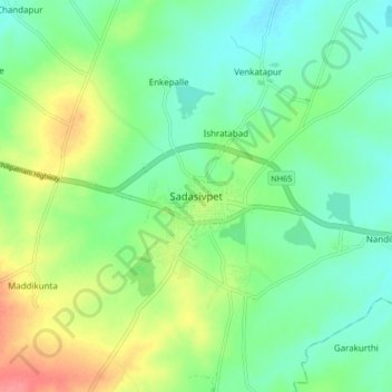
Sadasivpet topographic map

Click on the map to display elevation.

Sadasivpet

Sadashivpet is located at 17°37′00″N 77°57′00″E / 17.6167°N 77.9500°E / 17.6167; 77.9500. It has an average elevation of 534 meters (1755 feet). From Sadashivpet to Hyderabad 65 km, Vikarabad 36 km, Sadashivpet Road Railway Station 18 km, Bidar 69 km, Zahirabad 36 km, Gulbarga 154 km, SangaReddy 20 km.

Wikipedia (CC-BY-SA 3.0)

About this map

Name: Sadasivpet topographic map, elevation, terrain.

Location: Sadasivpet, Sadasivpet mandal, Sangareddy District, Telangana, 502291, India (17.58119 77.91033 17.66119 77.99033)

Average elevation: 538 m

Minimum elevation: 514 m

Maximum elevation: 584 m

Gear up for your next adventure:

🐕Hiking Dog Pack - Let your canine companion carry their own water and food
🛏️Sleeping Bag - Warm and compact sleeping bags for outdoor camping
🛶Waterproof Dry Bags - Keep electronics and clothes dry during river crossings
⛺Family Camping Tent - Spacious tent suitable for family camping trips
🧴Bear Spray Holster - Quick-access carry for essential Canadian wilderness safety

As an Amazon Associate, this site earns from qualifying purchases at no extra cost to you.