Geolocate

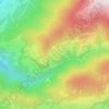
Sarns - Sarnes topographic map

Click on the map to display elevation.

About this map

Name: Sarns - Sarnes topographic map, elevation, terrain.

Location: Sarns - Sarnes, Klerant - Cleran, Brixen - Bressanone, Eisacktal - Valle Isarco, South Tyrol, Trentino – Alto Adige/Südtirol, Italy (46.68266 11.64119 46.69513 11.65718)

Average elevation: 726 m

Minimum elevation: 540 m

Maximum elevation: 1,244 m

Other topographic maps

Click on a map to view its topography, its elevation and its terrain.
Gear up for your next adventure:

🎒Backpack Rain Cover - External shield to keep your entire pack dry
💧Hydration Bladder - Hands-free hydration solution for long treks
👟Leg Gaiters - Keep debris, mud, and snow out of your boots
🧭GPS Handheld Device - Reliable GPS navigation for outdoor adventures
🔭Outdoor Binoculars - Lightweight binoculars for birdwatching and hiking

As an Amazon Associate, this site earns from qualifying purchases at no extra cost to you.